Garmin GPSMAP 9022 Premium chartplotter with worldwide base map - thumbnail 2
Garmin GPSMAP 9022 Premium chartplotter with worldwide base map - thumbnail 3
Garmin GPSMAP 9022 Premium chartplotter with worldwide base map - thumbnail 4
Garmin GPSMAP 9022 Premium chartplotter with worldwide base map - thumbnail 5
Garmin GPSMAP 9022 Premium chartplotter with worldwide base map - 2
Garmin GPSMAP 9022 Premium chartplotter with worldwide base map - 3
Garmin GPSMAP 9022 Premium chartplotter with worldwide base map - 4
Garmin GPSMAP 9022 Premium chartplotter with worldwide base map - 5

Garmin GPSMAP 9022 Premium chartplotter with worldwide base map

SKU:010-02674-00

Regular price
£9,999.95 inc. VAT
Sale price
£9,999.95
Regular price
inc. VAT
£11,639.99
You save £1,640.04

FREE UK shipping on orders over £150. Exclusions apply.
Shipping calculated at checkout.

Click & Collect - available at Morgan Marine, Brightlingsea.

30-days Free Returns - see our returns policy

3 - 5 Working Days Delivery


Rated - 4.6 / 5 on Google ⭐⭐⭐⭐⭐

Trusted - Marine supplier since 1972

Fast - UK delivery


Garmin GPSMAP 9022 Premium chart plotter with worldwide base map

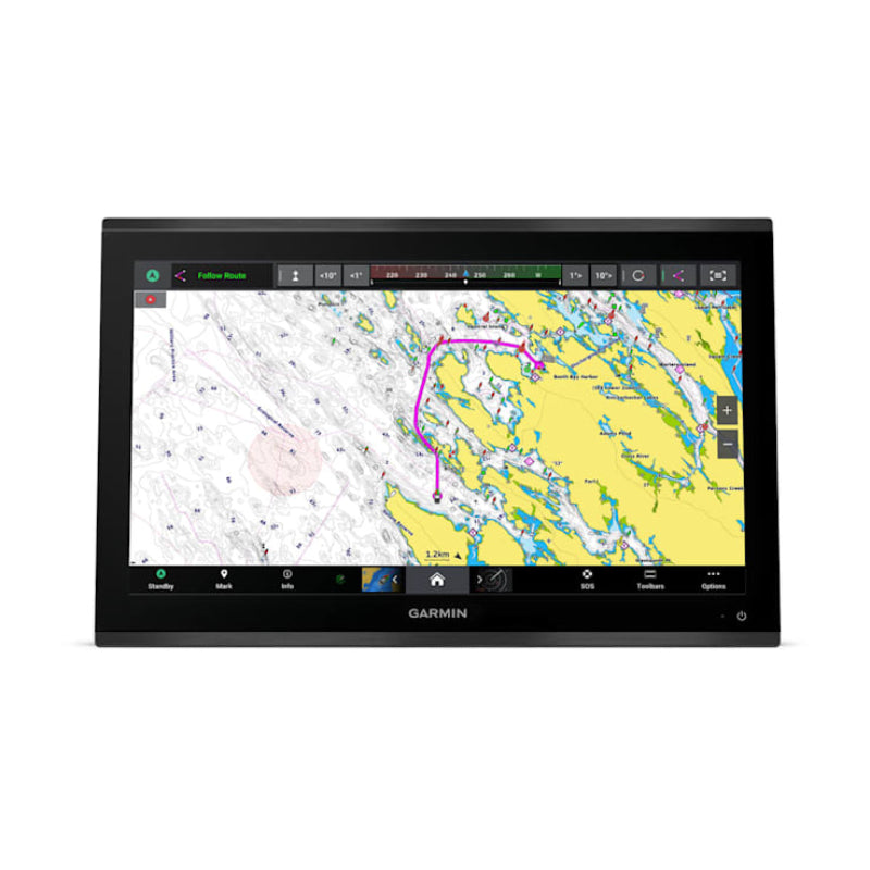
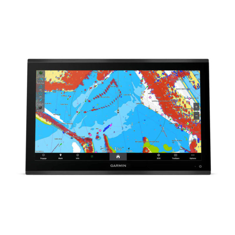
Garmin GPSMAP 9022 Premium chart plotter with worldwide base map are a high-end, 22-inch 4K resolution touchscreen chart plotter with a worldwide base map, designed for a luxurious glass helm experience. It features a processor that is seven times faster than previous generations and offers extensive networking capabilities for integrating various marine systems.

Garmin GPSMAP 9022 Premium chart plotter with worldwide base map Key Features

The GPSMAP 9022 features a 22-inch 4K IPS sunlight-readable touchscreen display with a resolution of 3840 x 2160 pixels and an edge-to-edge glass design. It has a powerful processor for faster chart drawing and route calculation with optional Garmin Navionics+™ charts. 
Networking capabilities include the gigabit-speed Garmin BlueNet™ for connecting multiple devices like chartplotters, cameras, radars, and sonars, as well as NMEA 2000® and NMEA 0183 networks. The chartplotter supports comprehensive audio and video integration, including HDCP distribution and the Garmin Surround View Camera System. It also allows monitoring and control of vessel systems through OneHelm™.
For navigation, it includes a worldwide basemap and supports optional premium charts such as Garmin Navionics+™ and Garmin Navionics Vision+™, which offer features like Auto Guidance+ technology and high-resolution relief shading (subscriptions required). The device is compatible with various Garmin sonar modules for displaying high-definition sonar targets. It is built for harsh marine conditions with an IPX7 water-resistance rating. Connectivity includes BLUETOOTH® and ANT® technologies for connecting to smartphones via the ActiveCaptain® app or Garmin smartwatches.

In the Box

The  Garmin GPSMAP 9022 comes with the chartplotter, trim snap cover, protective cover, flush mount hardware, power cable, GPS 24xd NMEA 2000® position receiver and antenna kit, NMEA 2000 backbone/drop cable, NMEA 2000 power cable, NMEA 2000 T-connector and terminator kit, and documentation


Garmin GPSMAP 9022 Premium chart plotter with worldwide base map FAQs

  • Display: The GPSMAP 9022  features a premium 22-inch 4K IPS sunlight-readable touchscreen display with an edge-to-edge glass helm design.
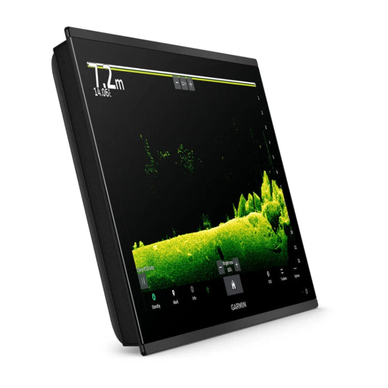
  • Sonar: Transducers for the built-in 1 kW xCHIRP, Garmin RapidReturn™ sonar and UHD scanning sonar are sold separately. The unit itself has the processing power and connections to support a wide range of Garmin sonar modules.
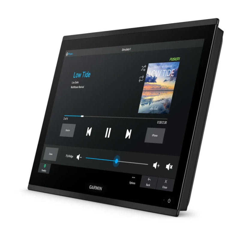
  • Connectivity: The chartplotter offers extensive connectivity options, including Wi-Fi®, BLUETOOTH®, ANT® technologies, NMEA 2000® and the new, faster Garmin BlueNet™ network for integrating multiple devices like cameras, radar, and additional chartplotters.
  • Installation: The device is designed for flush or flat mounting in a glass helm setup and has an IPX7 water-resistance rating.
  • Data Management: The unit accepts two SD cards for expanded memory and data storage, with capacity for 5,000 waypoints, 50,000 track points, and 100 navigation routes.
  • Control Integration: It supports digital switching systems via OneHelm™ integration for monitoring and controlling various onboard systems.


You May Be Interested