Collection: Electronic Charts
Electronic Charts
Navigate with confidence using our collection of high-quality electronic charts. Designed for optimal marine navigation, these charts provide accurate mapping and real-time information to guide you safely through coastal waters, harbors, and open seas. With features like detailed topography, navigation aids, and clear route planning, our electronic charts are an essential tool for sailors and boaters looking to enhance their onboard navigation systems. Compatible with various GPS and multi-function displays, these charts ensure your journey is smooth and well-guided.
Shop now at Morgan Marine Chandlery for the best electronic charts to improve your marine navigation experience from great brands like Raymarine.
Read more...
9 Results
-
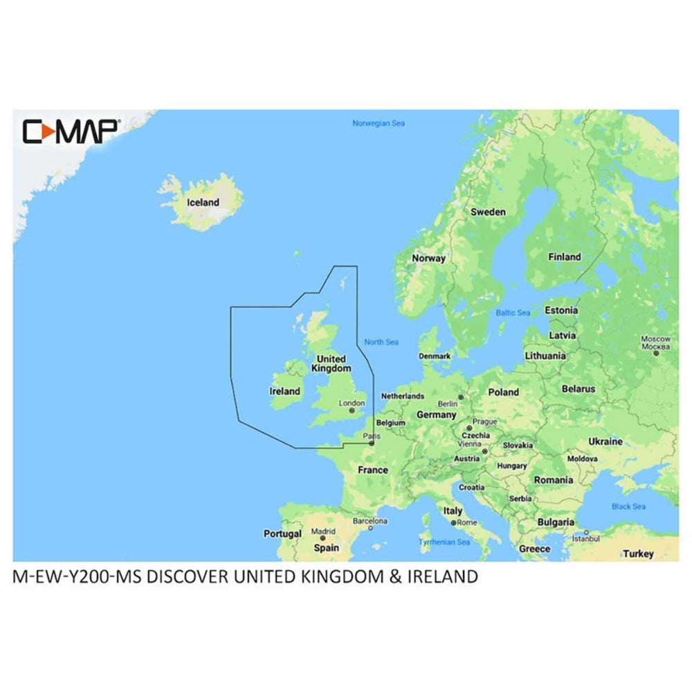
C-Map Discover M-EW-Y200-MS United Kingdom & Ireland (Regular)
-
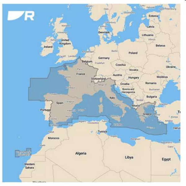
Raymarine LightHouse Chart (preloaded with Mediterranean region charts) on 32 Gb micro SD card
 Vendor: RaymarineView Details
- Regular price
- £195.00
- Sale price
- £195.00
- Regular price
-
- Unit price
- / per
-
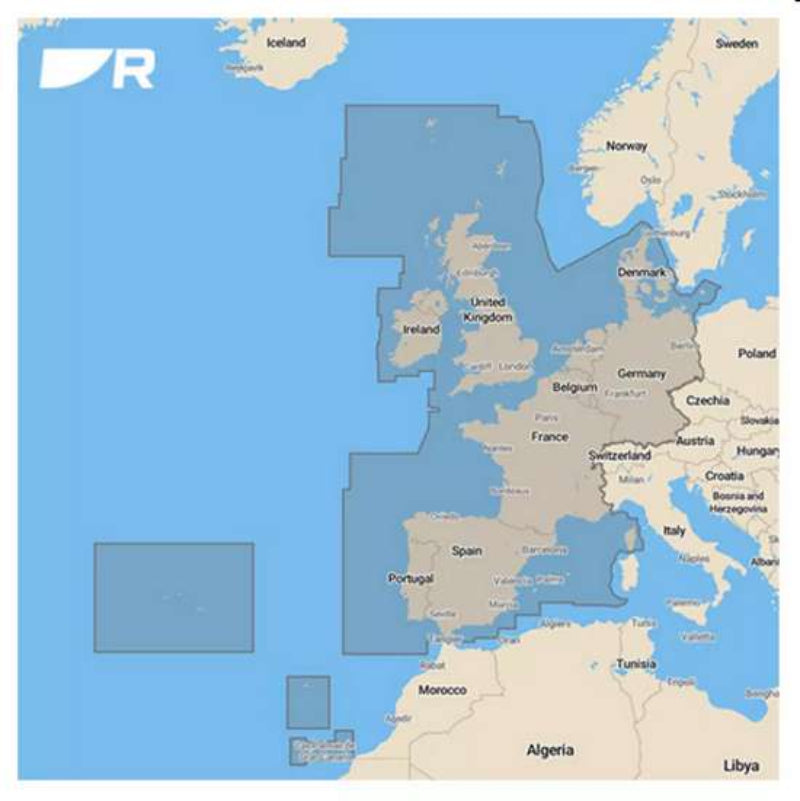
Raymarine LightHouse Chart (preloaded with Western Europe charts) on 32 Gb micro SD card
 Vendor: RaymarineView Details
- Regular price
- £195.00
- Sale price
- £195.00
- Regular price
-
- Unit price
- / per
-
Raymarine LightHouse Chart (preloaded with Northern Europe charts) on 32 Gb micro SD card
 Vendor: RaymarineView Details
- Regular price
- £195.00
- Sale price
- £195.00
- Regular price
-
- Unit price
- / per
-
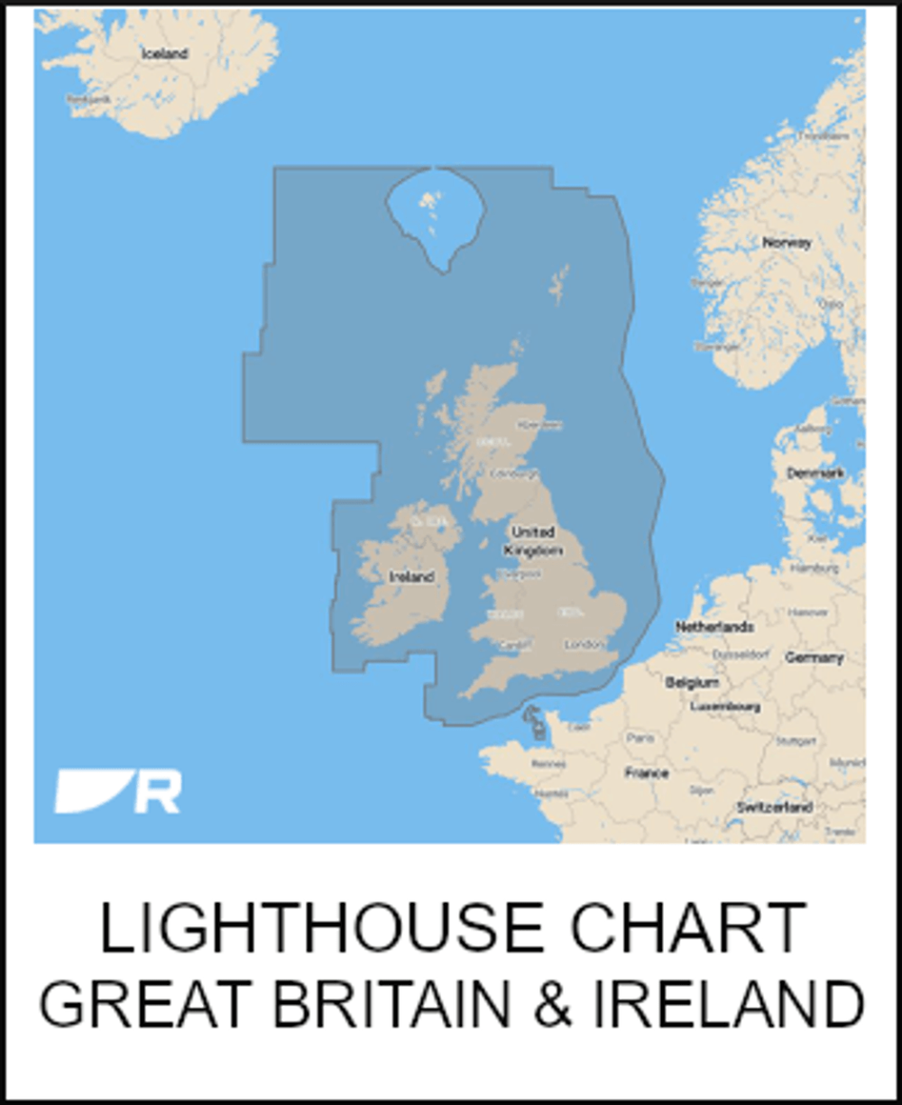
Raymarine LightHouse Chart (preloaded with UK & Ireland charts) on 32Gb micro SD card
 Vendor: RaymarineView Details
- Regular price
- £145.00
- Sale price
- £145.00
- Regular price
-
- Unit price
- / per
-
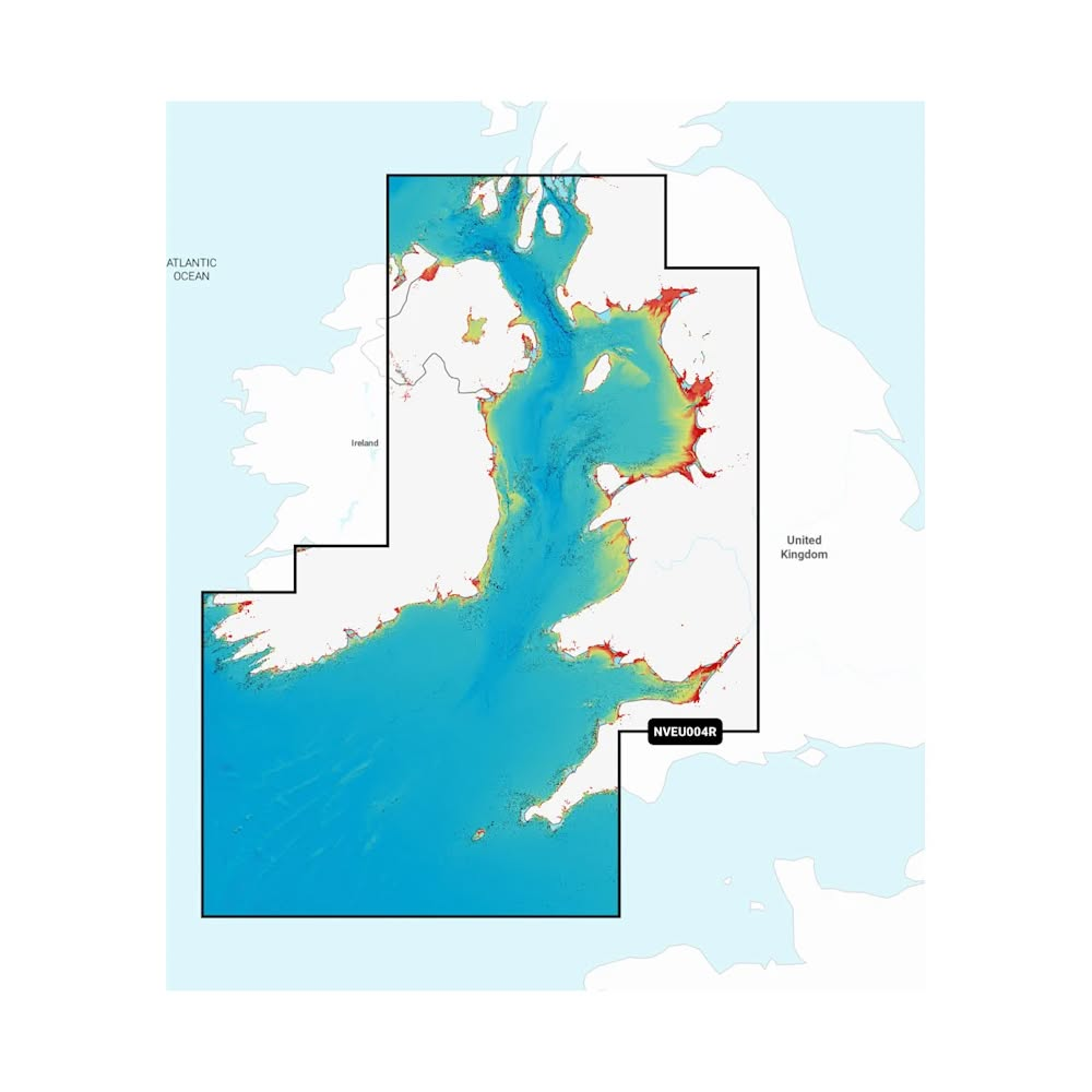
Irish Sea - Marine Charts
-
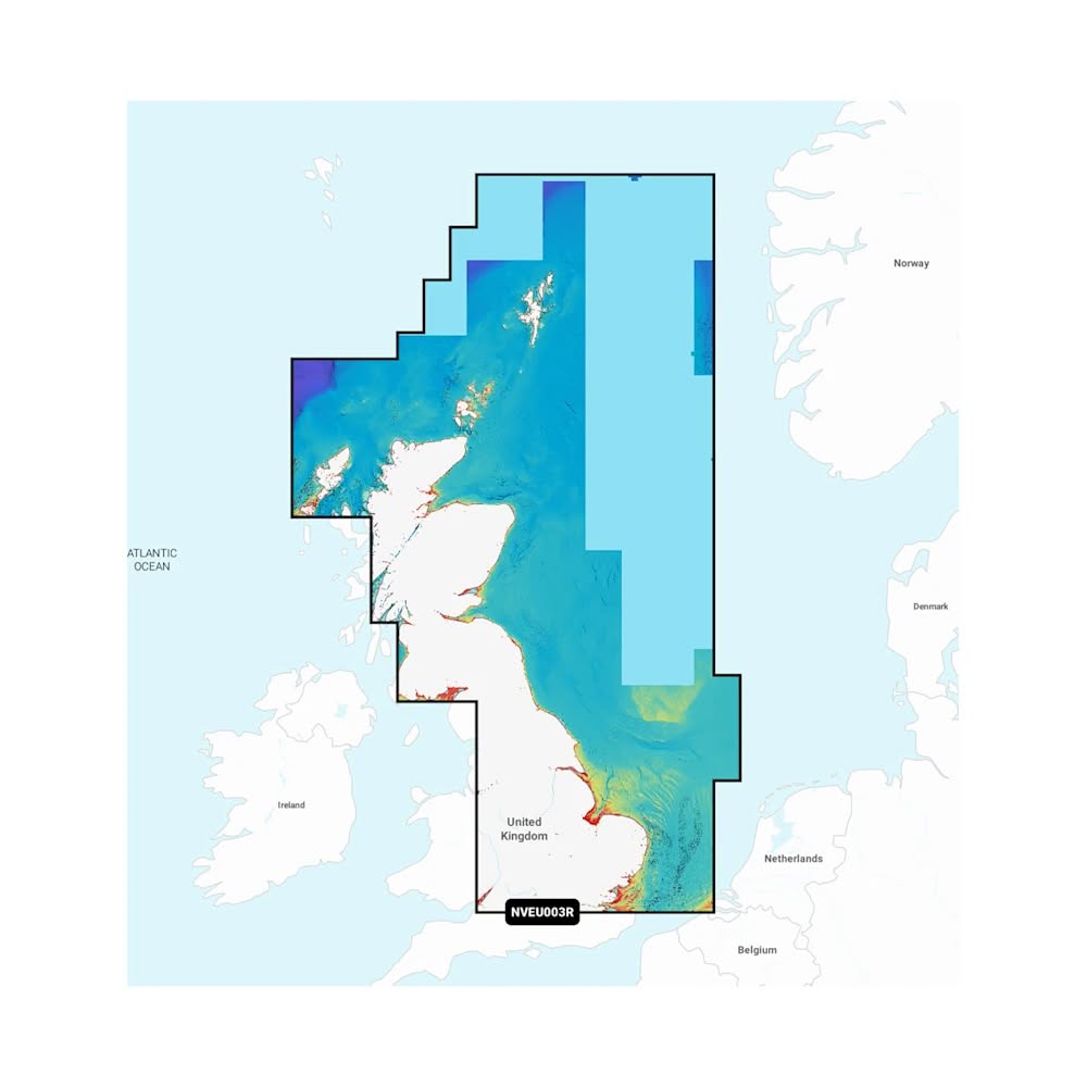
Great Britain, Northeast Coast - Marine Charts
-
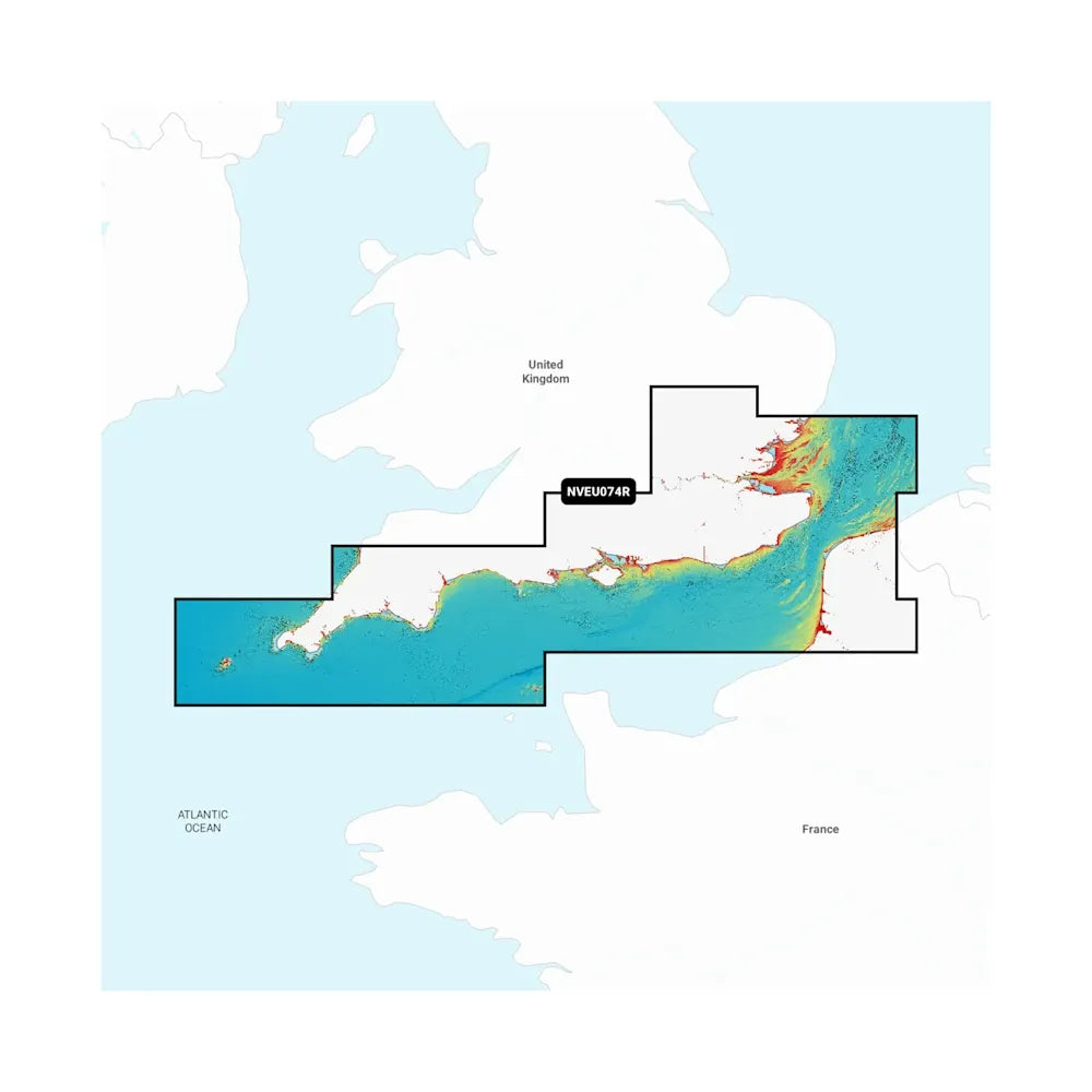
England, South Coast - Marine Charts
-
U.K., Ireland & Holland - Marine Charts


Our Customers Are Saying
4.84 ★ (210)
Verified