Garmin GPSMAP 8424 MFD With Worldwide Base map
SKU:010-01512-00
- Regular price
- £11,995.00 inc. VAT
- Sale price
- £11,995.00
- Regular price inc. VAT
-
£13,750.00
Flexible Shipping Options - inc. Next Working Day UK Mainland
Click & Collect - available at Morgan Marine, Brightlingsea.
30-Days Free Returns - see our returns policy
Rated - 4.6 / 5 on Google ⭐⭐⭐⭐⭐
Trusted - Marine supplier since 1972
Fast - UK delivery
Garmin GPSMAP 8424 MFD With Worldwide Base map
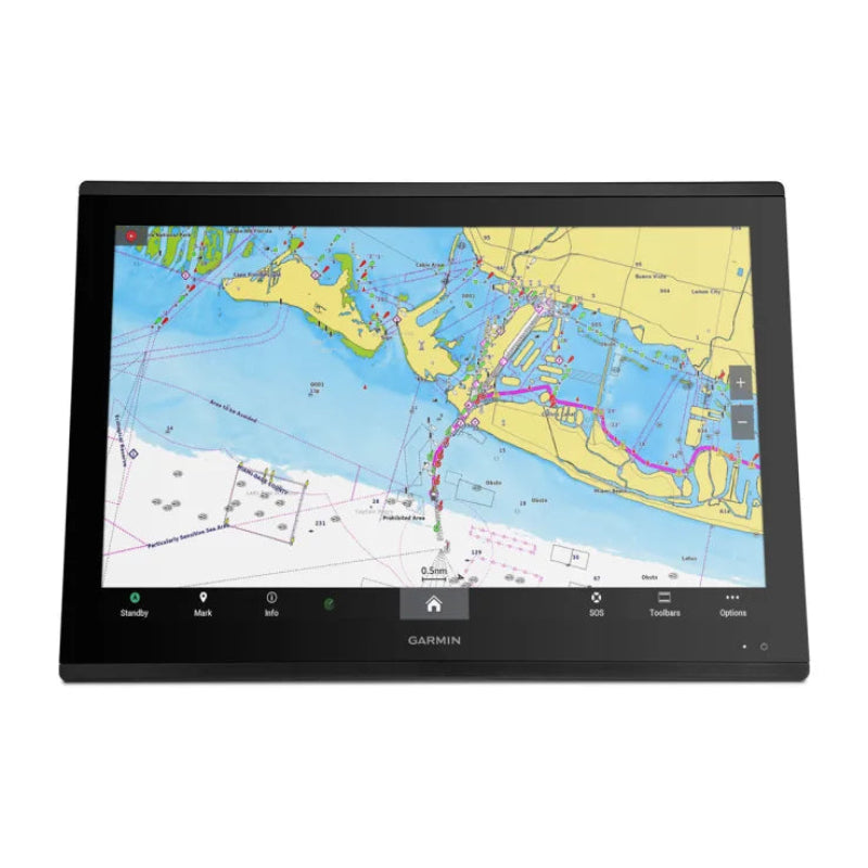
Garmin GPSMAP 8424 MFD With Worldwide Base map are the premier 24-inch flagship chartplotter designed for high-performance marine navigation. It is the industry's first integrated 4K resolution touchscreen chartplotter, specifically engineered for large-format glass helms on luxury and commercial vessels over 12 meters.
Garmin GPSMAP 8424 MFD With Worldwide Base map Key Features
- 4K Display: Features a 24-inch 4K IPS sunlight-readable touchscreen (3840 x 2160 pixels) with a premium edge-to-edge glass design.
- High-Speed Processing: Delivers up to 7 times faster processing power than previous generations, allowing for rapid chart drawing and route calculation.
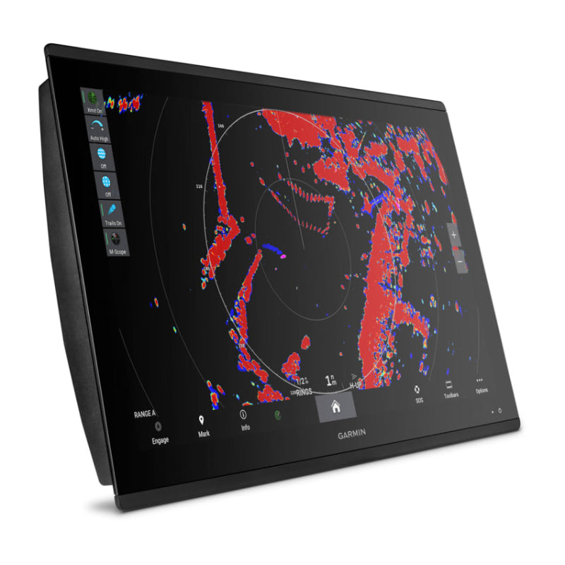
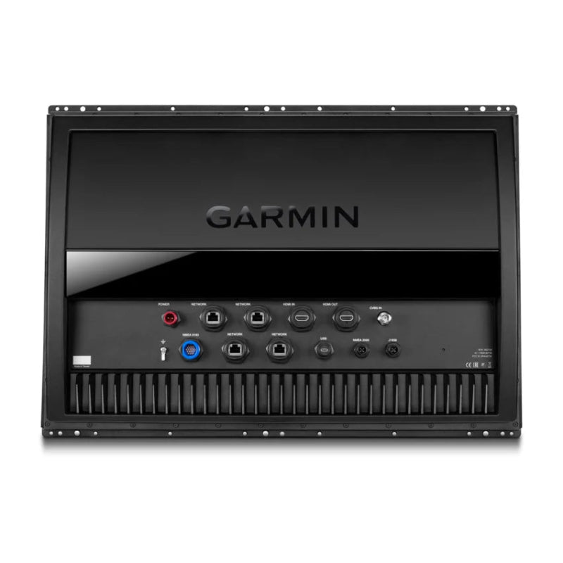
- Advanced Networking: Utilizes the Garmin BlueNet gigabit network for speeds up to 10 times faster than standard marine networks, supporting extensive multi-device integration (cameras, radars, sonars).
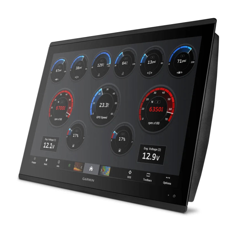
- Comprehensive Integration: Supports OneHelm digital switching to monitor and control third-party vessel systems, as well as NMEA 2000 and NMEA 0183 connectivity.
- Cartography: Ships with a Worldwide Basemap for general reference. For detailed navigation, it is compatible with Garmin Navionics+ and Navionics Vision+ charts.
- Professional Sonar: While transducers are sold separately, the unit supports ultra-high-definition scanning sonar and LiveScope technology through compatible black box modules.
Garmin GPSMAP 8424 MFD With Worldwide Base map FAQs
- What are the physical dimensions and weight of the device? Dimensions: The unit measures 22.8" x 16.1" x 2.8" (60.0 cm x 41.0 cm x 7.1 cm). Weight: It weighs approximately 18.95 lbs (8.60 kg).
-
Is the display a touchscreen? Yes, the Garmin GPSMAP 8424 MFD
features a 24-inch full-HD IPS touchscreen display with an anti-glare finish and a resolution of 1920 x 1200 pixels. - Is the device waterproof? Yes, the device has a water rating of IPX7, meaning it can withstand accidental immersion in 1 meter of water for 30 minutes.
- Can I connect other marine devices to it? Yes, it offers extensive network connectivity, including NMEA 2000® and NMEA 0183 compatibility, Garmin Marine Network ports, Wi-Fi, and ANT® technology, allowing integration with radar, sonar, autopilots, cameras, digital switching, and more.
- Does the unit have built-in sonar capabilities? The base model does not have built-in sonar, but it is compatible with external black box sonar systems (such as the GCV™ or GSD™ black boxes) to enable CHIRP, ClearVü, and SideVü scanning sonar technologies.
- How many waypoints and routes can I save? The device supports up to 5,000 waypoints, 50 saved tracks (with 50,000 track points each), and 100 navigation routes (up to 250 waypoints per route).
- What maps are included with the device? The device comes preloaded with a worldwide basemap and supports optional premium maps and charts like BlueChart® g3, BlueChart® g3 Vision, LakeVü g3, and LakeVü g3 Ultra.
- How do I update the maps and software? You can update maps and software using a Wi-Fi network connection without a computer, or via an SD card using the Garmin SD card reader accessory.
- Do I need a subscription for map updates? Initial purchases or renewals of Navionics® Boating app or Garmin.com charts often involve a subscription that automatically renews yearly for continued access to updates and features.