Garmin GPSMAP 1222 - Worldwide Base map
SKU:010-01741-00
- Regular price
- £1,899.95 inc. VAT
- Sale price
- £1,899.95
- Regular price inc. VAT
-
£2,350.00
Flexible Shipping Options - inc. Next Working Day UK Mainland
Click & Collect - available at Morgan Marine, Brightlingsea.
30-Days Free Returns - see our returns policy
Rated - 4.6 / 5 on Google ⭐⭐⭐⭐⭐
Trusted - Marine supplier since 1972
Fast - UK delivery
Garmin GPSMAP 1222 - Worldwide Base map
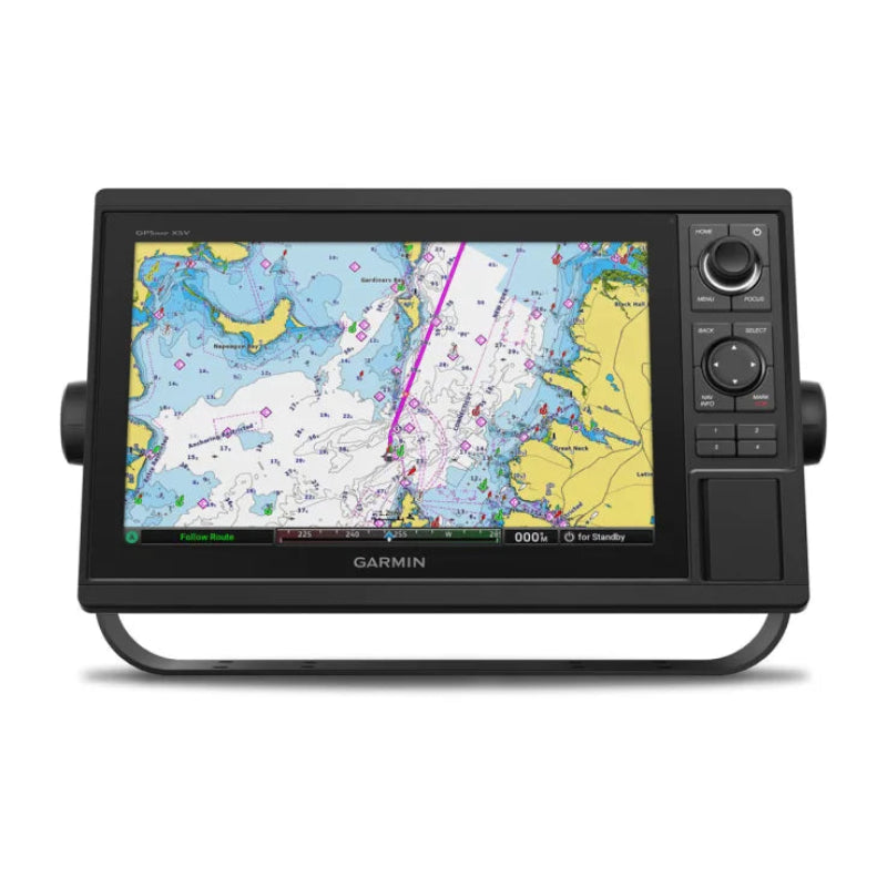
Garmin GPSMAP 1222 - Worldwide Base map are the ultimate all-in-one solution for mariners who demand a large, clear display and intuitive physical controls. Designed for those who venture into diverse conditions, the 12-inch high-resolution screen provides exceptional visibility, while the built-in keypad and multifunction control knob ensure you can navigate menus and adjust settings even with gloves on or in heavy seas.
Preloaded with a worldwide basemap, this unit serves as the perfect foundation for your marine electronics suite. Whether you are a coastal cruiser or a competitive offshore racer, the GPSMAP 1222 offers the seamless integration and high-speed processing required for modern navigation.
Garmin GPSMAP 1222 - Worldwide Base map Key Features
- Vivid 12-inch Display: A large, bright WXGA screen offering wider viewing angles and excellent clarity in direct sunlight, ensuring your charts and data are always readable.
- Tactile Keypad Interface: Features a full keypad, a multifunction control knob, and user-programmable keys for quick, efficient operation in all weather conditions.
- High-Speed 10 Hz GPS: The internal 10 Hz GPS and GLONASS receiver refreshes your position and heading 10 times per second, providing fluid movement on the screen and highly accurate waypoint marking.
- Full Network Integration: Easily share sonar, radar, maps, and user data across multiple units via the Garmin Marine Network. It also features NMEA 2000® and NMEA 0183 connectivity for autopilots, digital switching, VHF, and AIS.
- Built-in SailAssist™: Gain a competitive edge with pre-race guidance, including a virtual starting line, laylines, enhanced wind rose, and true/apparent wind data fields.
- Wireless Connectivity: Integrated Wi-Fi® allows you to pair with the free ActiveCaptain® app for access to OneChart™, smart notifications, and the Garmin Quickdraw™ Community.
- ANT® Connectivity: Connects wirelessly to your Garmin quatix® watch, gWind™ Wireless 2 transducer, and GNX™ Wind marine instruments.
- Expandable Maps: Features two SD™ card slots, allowing you to upgrade to Garmin Navionics+™ or premium Navionics Vision+™ for high-resolution relief shading and Auto Guidance+ technology.
What’s in the Box?
-
- GPSMAP 1222 chartplotter
- Power/data cable
- NMEA 2000® T-connector & drop cable (2m)
- Bail mount kit with knobs
- Flush mount kit with gasket
- Protective cover & trim piece snap covers
- Full documentation
Morgan Marine Expert Tip:
The 1222 is a fantastic choice if you find touchscreens finicky in wet weather. It’s incredibly robust, and the ability to network it with a Garmin radar or Panoptix sonar makes it a powerful hub for any UK coastal or offshore vessel.
Garmin GPSMAP 1222 - Worldwide Base map FAQs
Does the GPSMAP 1222 have a touchscreen?
No, the GPSMAP 1222 is a fully keyed unit. It is specifically designed for mariners who prefer the tactile feel of physical buttons, a rotary control knob, and programmable shortcut keys. This is particularly advantageous in the UK, as physical keys are much easier to operate with wet hands or while wearing gloves in colder conditions.
What is the difference between the 1222 and the 1222xsv?
The standard GPSMAP 1222 (this model) is a dedicated chartplotter. It does not have a built-in sonar module. If you wish to see sonar on this unit, you would need to connect it to an external sonar black box (like a GSD™ or GCV™ module) or network it with another Garmin unit that has built-in sonar. The xsv version, by contrast, has the sonar technology built directly into the back of the unit.
What exactly does the "Worldwide Basemap" include?
The worldwide basemap provides a basic outline of coastlines, international borders, and major political boundaries. It is designed for general reference only. To get the high-detail depth contours, navigation marks, and port information required for safe navigation in UK and European waters, we highly recommend adding a Garmin Navionics+™ or Navionics Vision+™ microSD card.
Is this unit compatible with my existing Radar?
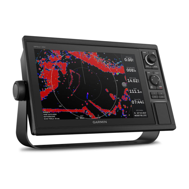
The GPSMAP 1222 is fully compatible with the Garmin Marine Network, meaning it works seamlessly with all current Garmin GMR™ series radar domes and open arrays. Once connected via a Garmin Network Cable, you can overlay radar images directly onto your charts for superior situational awareness.
Can I connect my engine data to the display?
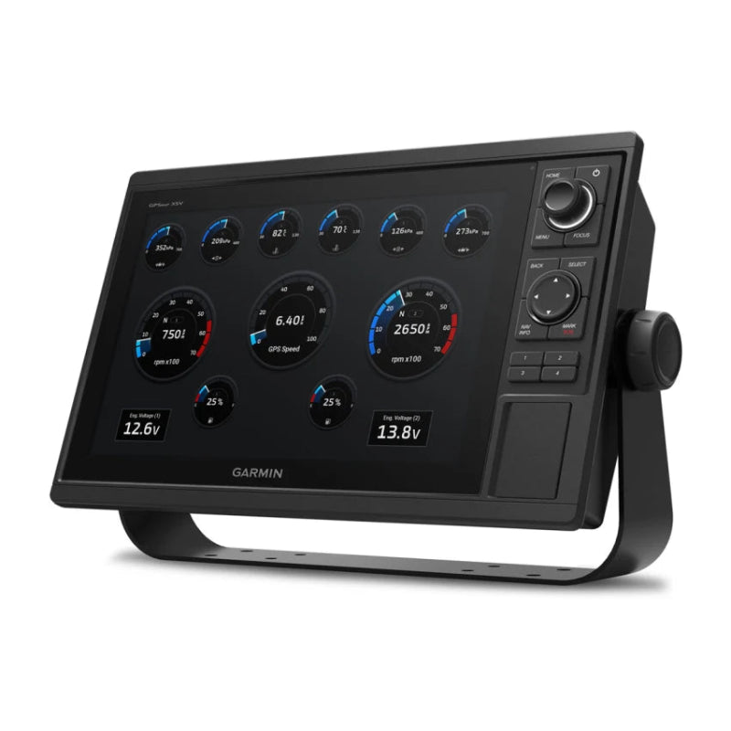
Yes. Using NMEA 2000® connectivity, the GPSMAP 1222 can display vital engine information such as RPM, fuel flow, temperature, and trim. You may require a specific gateway or cable depending on your engine manufacturer (e.g., Yamaha, Mercury, or Volvo Penta).
Does it support the Garmin ActiveCaptain® app?
Absolutely. With built-in Wi-Fi®, you can pair the 1222 with the free ActiveCaptain app on your smartphone or tablet. This allows you to update your software on the water, download new charts, and even receive smart notifications (calls and texts) directly on your 12-inch screen.
Is the GPSMAP 1222 suitable for sailing?
It is an excellent choice for sailors. It features Garmin SailAssist™, which provides essential racing and cruising data. This includes laylines, an enhanced wind rose, heading and course-over-ground lines, and a pre-race guidance page showing your virtual starting line and race timers.
How do I mount the unit?
The 1222 is versatile. It comes with a "Bail Mount" (a bracket for surface mounting) as well as a "Flush Mount" kit if you prefer the unit to be recessed directly into your dashboard for a sleek, integrated look.
Can I share data with my other Garmin screens?
Yes. If you have other Garmin Marine Network-compatible devices on board, you can share charts, user data (waypoints and routes), radar, and even sonar images across all screens on the boat.