Garmin GPSMAP 1022 - Worldwide Base map
SKU:010-01740-00
- Regular price
- £1,309.99 inc. VAT
- Sale price
- £1,309.99
- Regular price inc. VAT
-
£1,630.00
Flexible Shipping Options - inc. Next Working Day UK Mainland
Click & Collect - available at Morgan Marine, Brightlingsea.
30-Days Free Returns - see our returns policy
Rated - 4.6 / 5 on Google ⭐⭐⭐⭐⭐
Trusted - Marine supplier since 1972
Fast - UK delivery
Garmin GPSMAP 1022 - Worldwide Base map
Garmin GPSMAP 1022 - Worldwide Base map are a premier choice whether you’re navigating the Essex coast or heading further afield, this 10-inch chartplotter offers the perfect blend of traditional control and cutting-edge networking. Designed for those who prefer the tactile assurance of a keyed interface over a touchscreen—especially useful in cold or wet conditions—it’s the ultimate "all-in-one" solution for cruisers and sailors alike.
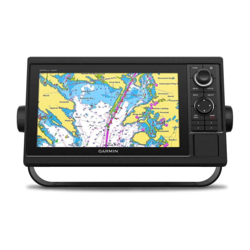
The GPSMAP 1022 is built for the adventurous spirit. Featuring a large, bright WSVGA display, it provides a crystal-clear view of your surroundings even in direct sunlight. This model comes preloaded with a worldwide basemap, serving as a solid foundation that you can easily upgrade with Garmin’s premium Navionics+™ or BlueChart® g3 Vision® charts.
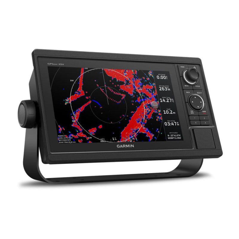
What sets this unit apart is its comprehensive networking. It’s not just a screen; it’s the brain of your boat. With full Garmin Marine Network and NMEA 2000® support, you can seamlessly share radar, sonar, and user data across multiple displays. Plus, with built-in Wi-Fi and ANT® connectivity, you can sync with your quatix® watch or the ActiveCaptain® app to manage your marine experience from anywhere on board.
Garmin GPSMAP 1022 - Worldwide Base map Key Features
- Tactile Keypad Interface: Features a multifunction control knob and user-programmable keys for quick, precise operation—even with gloves on.
- High-Sensitivity 10 Hz GPS: Refreshes your position and heading 10 times per second, ensuring on-screen movement is fluid and marking waypoints is incredibly accurate.
- Advanced Networking: Share sonar, maps, radar, and IP cameras across units via the Garmin Marine Network; includes NMEA 2000 and NMEA 0183 for autopilots and AIS.
- Built-in SailAssist: Gain a competitive edge with a pre-race guidance page, laylines, race timer, and wind data—ideal for both racers and leisure cruisers.
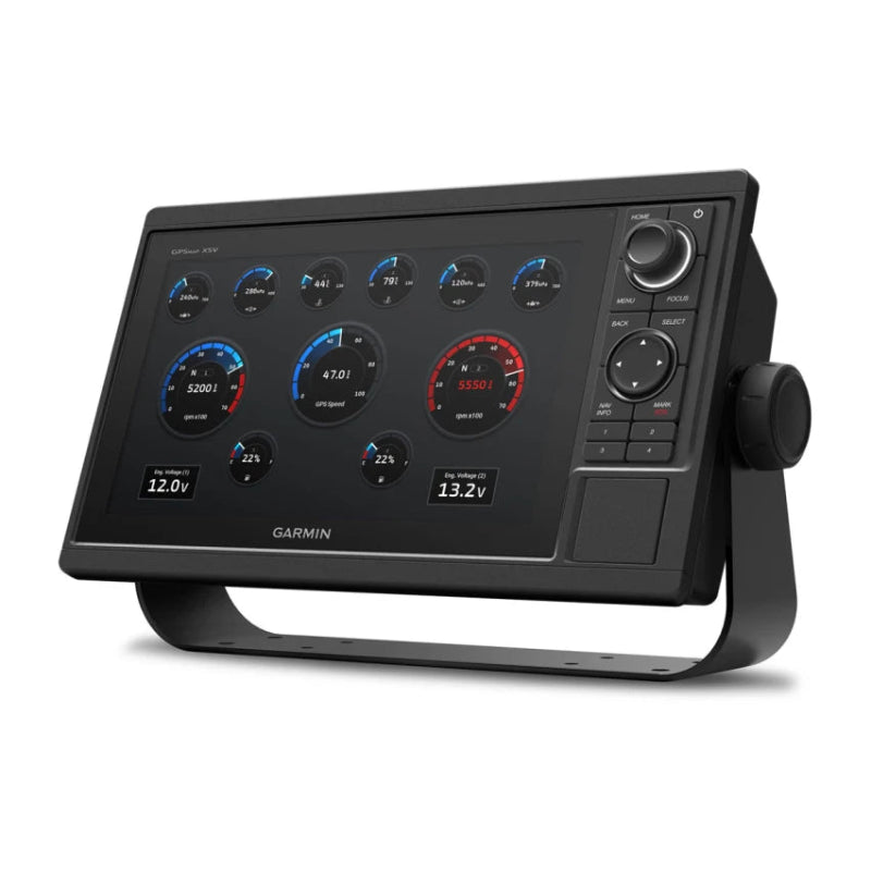
- Engine Connectivity: Monitor your vessel’s health by connecting directly to compatible Mercury, Yamaha, and other engine systems to view RPMs and fuel flow.
- Wireless Ecosystem: Built-in Wi-Fi for the ActiveCaptain® app and ANT® technology for connecting to Garmin nautix™ in-view displays or gWind™ transducers.
- Expandable Storage: Two SD™ card slots allow for easy map upgrades and data storage.
Technical Specifications
-
- Dimensions: 31.8 x 18.5 x 6.9 cm
- Display Size: 10.1" (25.7 cm) diagonal
- Resolution: 1024 x 600 pixels
- Water Rating: IPX7 (Withstands incidental water exposure)
- Mounting: Bail or Flush mount options included
- Receiver: 10 Hz GPS / GLONASS
In the Box:
-
- GPSMAP 1022
- chartplotter,
- power/data cable,
- NMEA 2000 T-connector,
- NMEA 2000 drop cable (2m),
- bail mount kit,
- flush mount kit, and protective cover.
Garmin GPSMAP 1022 - Worldwide Base map FAQs
Does this unit have a touchscreen?
No, the GPSMAP 1022 is a dedicated keyed chartplotter. It features a bright 10-inch colour display controlled via a high-quality keypad interface and a multifunction control knob. This is a favourite for many of our customers because it allows for precise operation even in rougher seas or when wearing gloves—situations where touchscreens can sometimes be a bit fiddly.
What is the difference between the GPSMAP 1022 and the 1022xsv?
This specific model is the GPSMAP 1022 (Worldwide Basemap), which is a "Chartplotter Only" unit. It does not have built-in sonar capabilities. If you require "plug-and-play" sonar to see fish and structure directly through the unit, you would need the xsv version. However, because this unit is fully network-compatible, you can still view sonar data on this screen if it is shared from another Garmin sonar-enabled device on your boat’s network.
What maps are preloaded on this device?
This unit comes preloaded with a Worldwide Basemap. This provides a general reference for global coastlines and major inland waters. For detailed navigation in UK and European waters, we highly recommend upgrading to Garmin Navionics+™ or Garmin Navionics Vision+™ cartography, which provides high-resolution depth contours and Auto Guidance+™ technology.
How accurate is the GPS tracking?
It’s exceptionally fast and accurate. It features a built-in 10 Hz GPS and GLONASS receiver that refreshes your position and heading 10 times every second. This ensures that the movement of your boat on the screen looks fluid and real-time, which is crucial when navigating tight channels or marking precise waypoints.
Can I connect this to my existing boat instruments?
Absolutely. This unit is the perfect "hub" for a modern vessel. It supports NMEA 2000® and NMEA 0183, meaning you can easily connect it to your autopilot, AIS, VHF radio, engine data, and Fusion-Link™ audio systems. It also has two Garmin Marine Network ports for sharing data like radar and IP cameras across multiple screens.
Does it have built-in Wi-Fi?
Yes. The built-in Wi-Fi allows you to pair the unit with the free ActiveCaptain® app. You can use this to update your software, purchase new charts, and even receive "Smart Notifications" (like texts or calls) directly on your plotter screen while your phone stays safe and dry in a locker.
Is this unit suitable for sailing?
It’s an excellent choice for sailors. It includes Garmin's SailAssist™ features, providing a pre-race guidance page, virtual starting line, laylines, and a race timer. You can also view enhanced wind roses and true/apparent wind data when connected to the appropriate wind sensors.
How do I mount the unit on my boat?
In the box, we include both a Bail Mount kit (for mounting on top of a console) and a Flush Mount kit (for a sleek, "in-dash" look). We also provide a protective sun cover to keep the screen safe when you’re not on the water.
Is it waterproof?
Yes, the GPSMAP 1022 is rated IPX7, meaning it can withstand incidental exposure to water of up to 1 metre for up to 30 minutes. It is built to handle the spray and rain common to the British boating environment.